Octave GeoMedia Mapping Manager
Formerly GeoMedia Mapping Manager, this enhanced toolset automates cartographic production so teams can deliver clean, consistent hardcopy maps faster.
Map production toolset
Deliver consistent maps faster
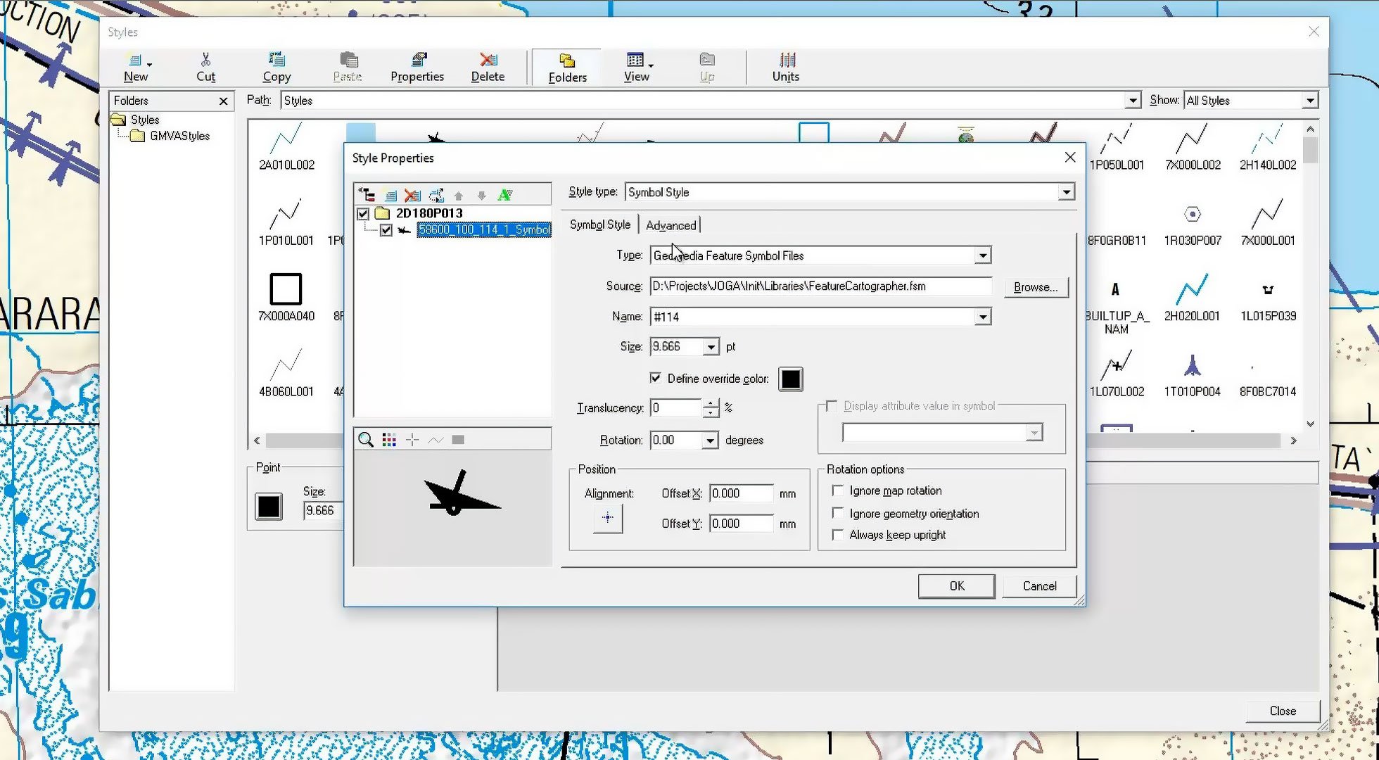
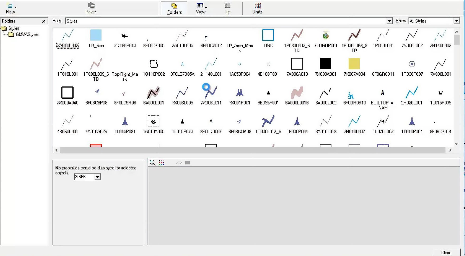
GeoMedia Mapping Manager combines GeoMedia Map Publisher and GeoMedia Feature Cartographer to support efficient production of standardized or custom maps. It separates cartographic edits from source data, helping maintain consistent styling while working with authoritative datasets. Automated symbology, conflict detection, generalization and sheet generation reduce manual steps and improve turnaround times at any scale.
Streamline map production
GeoMedia Mapping Manager enables accurate, visually consistent maps with fewer manual steps. Automated schema conversion, symbology assignment, conflict resolution and sheet creation ensure maps meet specifications every time. Cartographic edits remain separate from source data, streamlining revisions, while generalization tools support smaller scale outputs to reduce costs and speed delivery across large maps series.
Automated cartographic processing
GeoMedia Mapping Manager automates schema conversion and symbology assignment using preset cartographic rules. This reduces repetitive work and follows consistent standards across your entire production workflow.
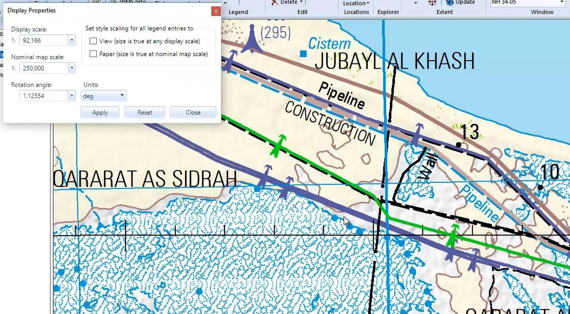
Improved map clarity with built-in conflict resolution
GeoMedia Mapping Manager can automatically detect symbol or feature overprints within defined tolerances and apply resolution strategies such as displacement, orientation or style suppression to produce clear, specification-compliant maps.
Instance-based edits for precise cartographic
GeoMedia Mapping Manager can adjust line patterns, symbol components, pattern spacing or geometry on individual features while preserving authoritative source data. All changes are stored separately in a cartographic database.
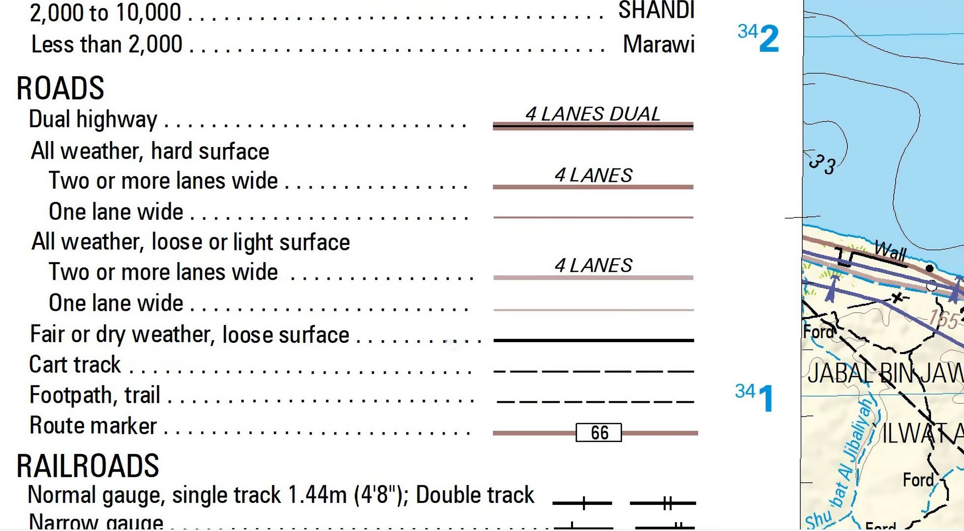
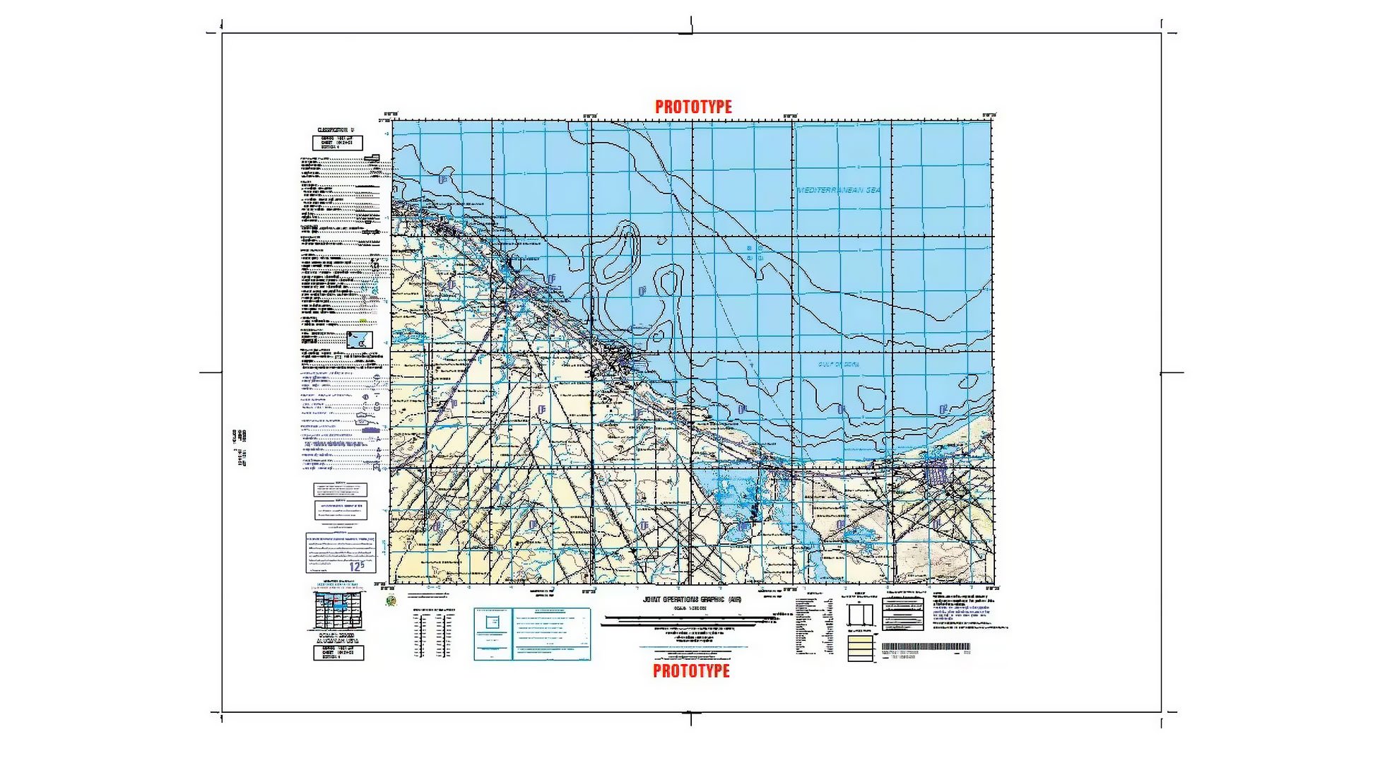
Full map sheets with grids, diagrams and marginalia
GeoMedia Mapping Manager can, based on selected specifications and map size, generate complete sheets with adjoining sheet diagrams, grids and required elements such as elevation guide boxes or maximum elevation figures.
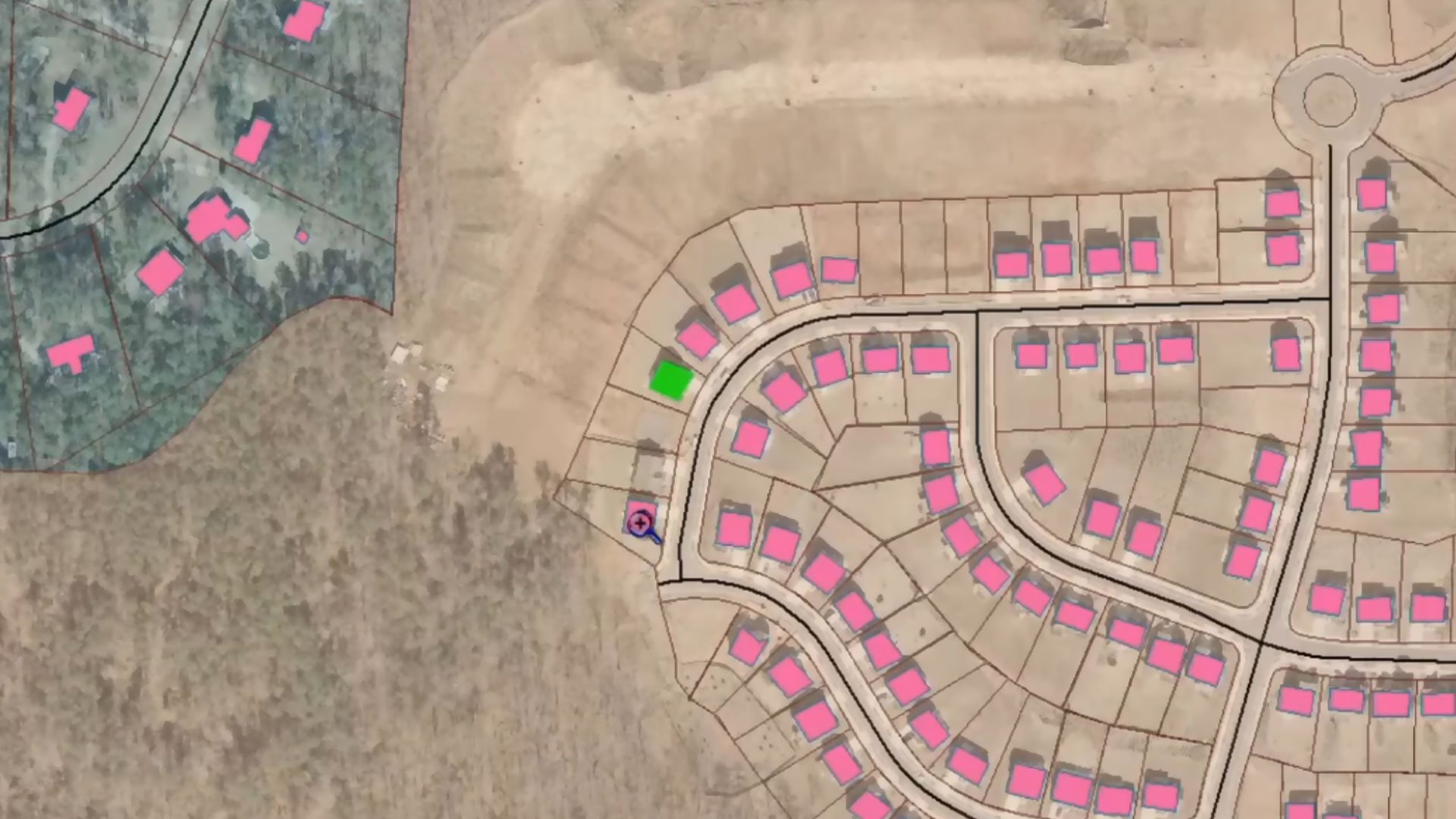
Cleaner map outputs
GeoMedia Mapping Manager can create smaller scale mapping products from detailed datasets. Buildings can be aggregated, boundaries extended and attributes recalculated to provide clean, readable maps at any scale.

Structured map revision tracking
GeoMedia Mapping Manager stores cartographic edits like style overrides, displacements and generalizations separately from source data. Each edit links directly to the original feature, enabling faster and more accurate map updates and simplifying production of new editions across entire map series.
Explore GeoMedia Mapping Manager
We're here to help
Get the help you need with direct access to support and resources.
