Octave Alto 제품 포트폴리오
기존 Luciad였던 Octave Alto는 고도화된 시각화 및 실시간 상황 인식을 위해 지능적으로 설계되었습니다.
강력한 커넥티드 솔루션을 위한 통합 지리공간 기술
데이터, 인사이트, 실행을 융합하는 지리공간 도구
Alto는 조직 전반의 데이터를 실시간 센서 피드, 엔터프라이즈 시스템, 공간 데이터 소스, 복잡한 2D/3D/4D 콘텐츠 등 하나의 연결된 환경으로 통합합니다. Alto의 분석 및 시각화 도구는 원시 정보를 명확한 운영 인사이트로 변환하며, 유연한 워크플로우와 보안 접근 제어를 통해 팀 간의 빠르고 조직적인 의사 결정을 지원합니다.
고성능 워크플로우를 위한 설계
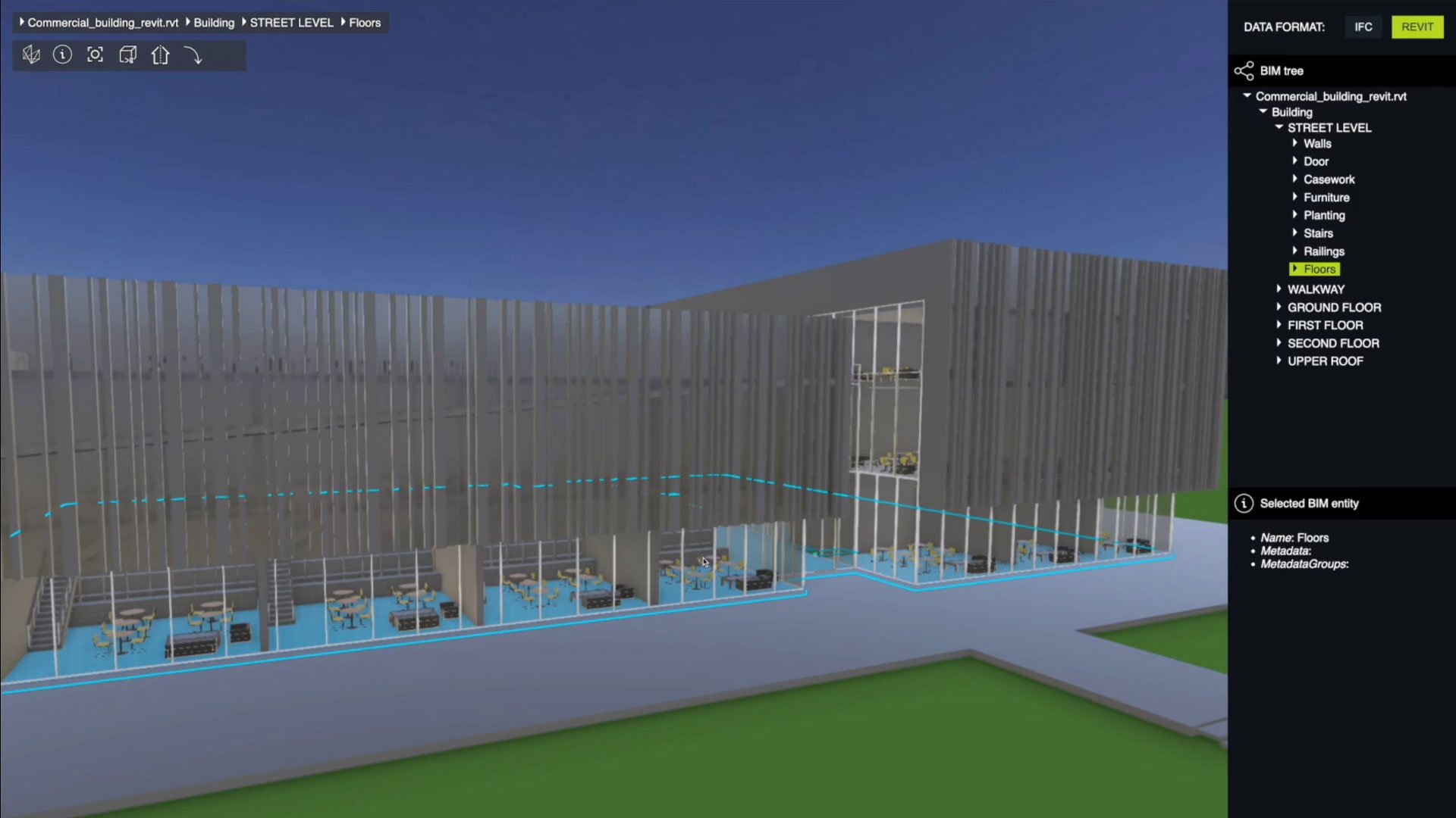
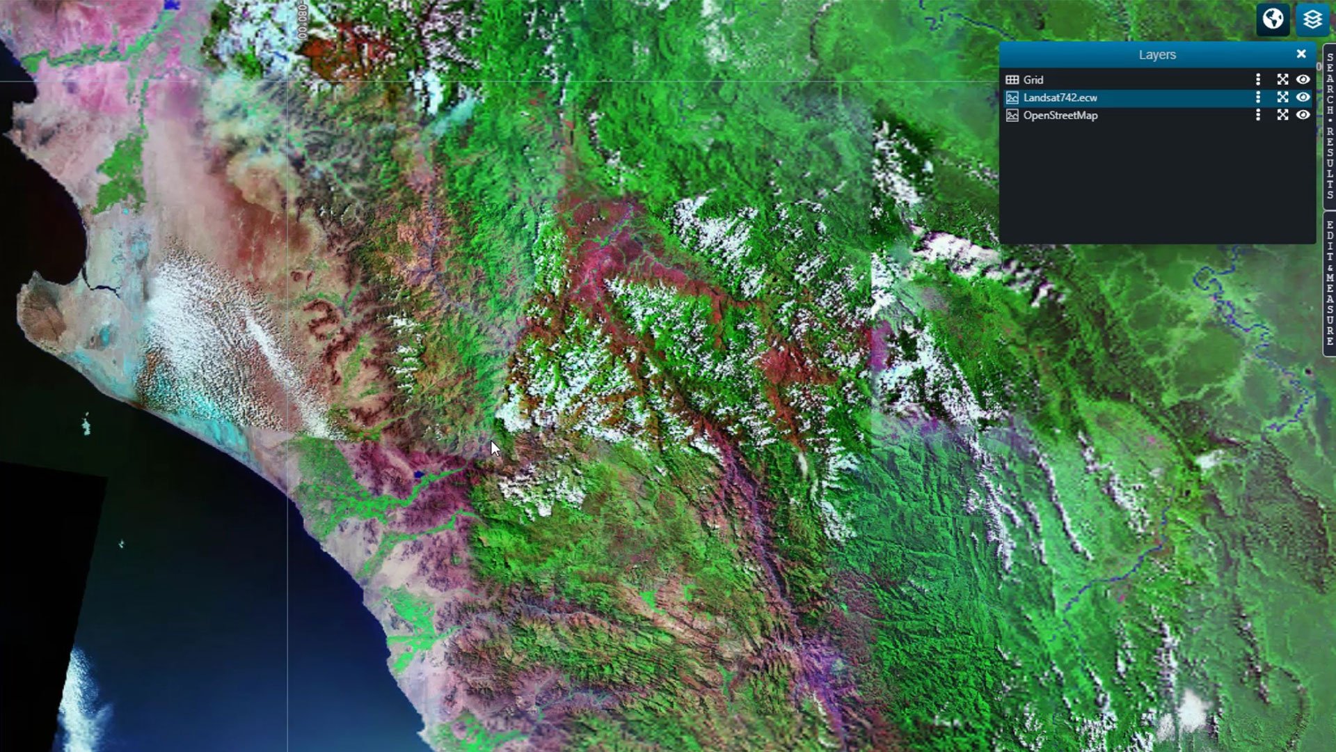
Unified data access across platforms
Alto connects smoothly to spatial, business and real‑time sources, bringing them together to ensure teams can work with accurate, synchronized information across desktop, web, mobile and server‑based systems.
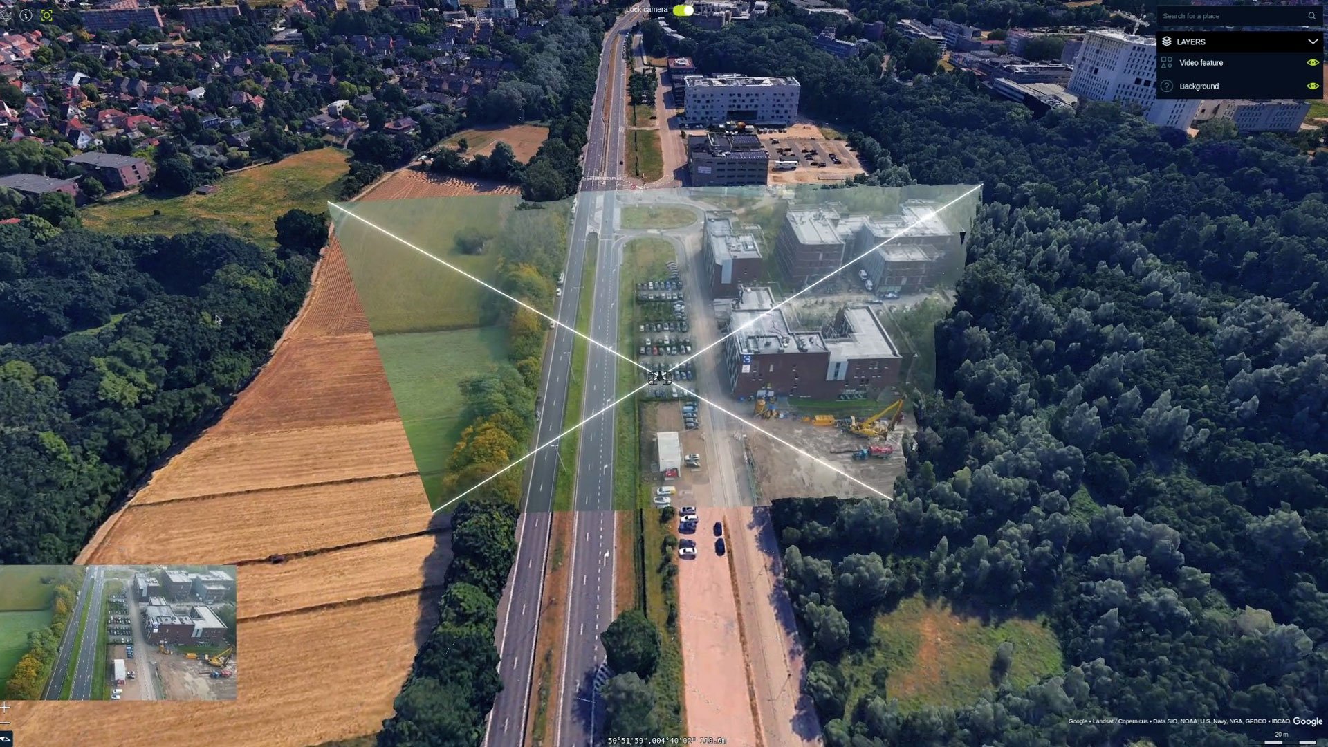
High‑fidelity 2D, 3D and time‑based visualization
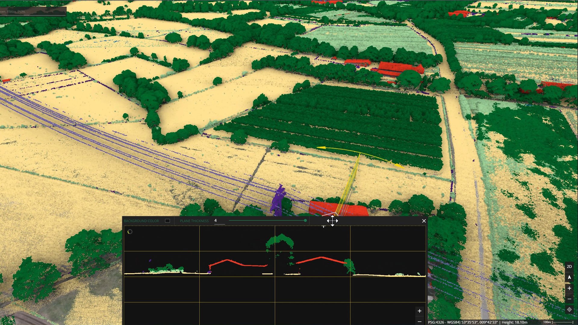
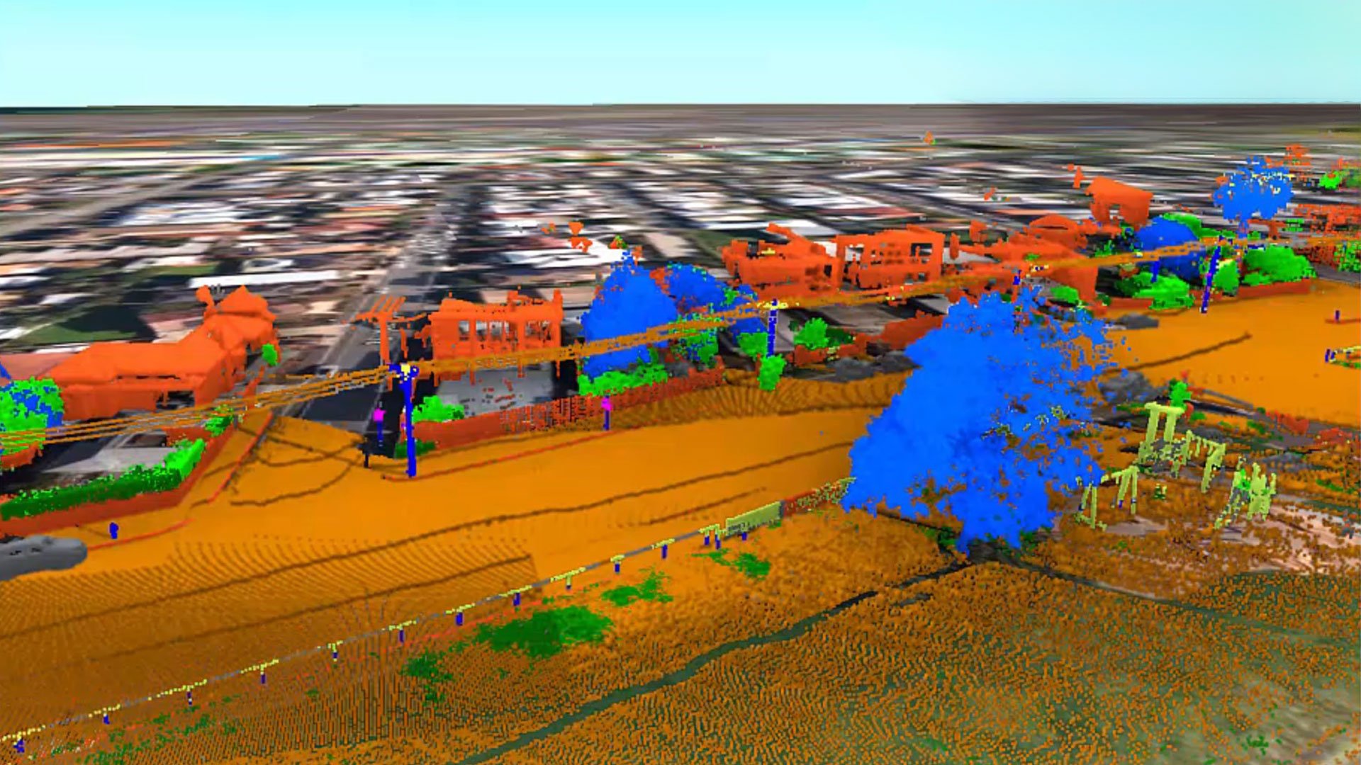
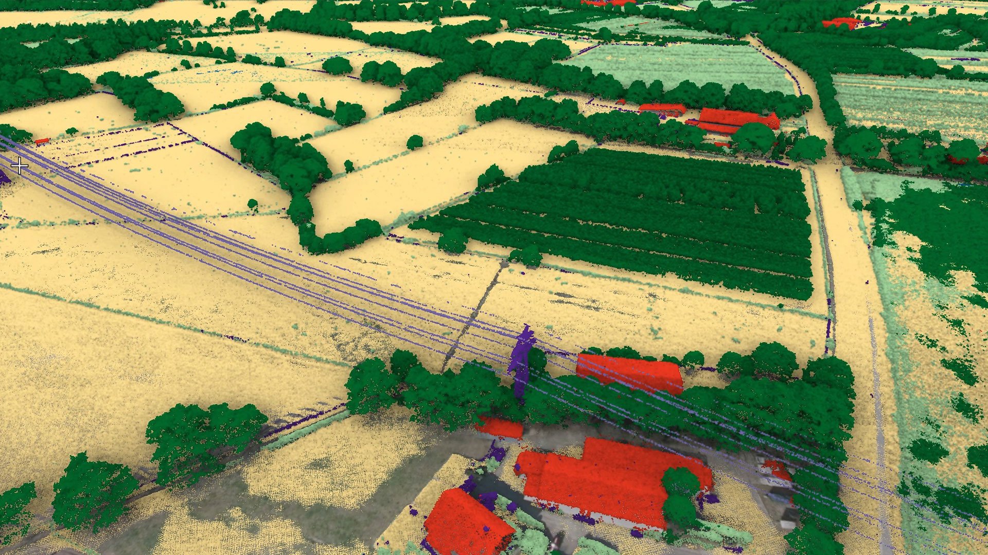
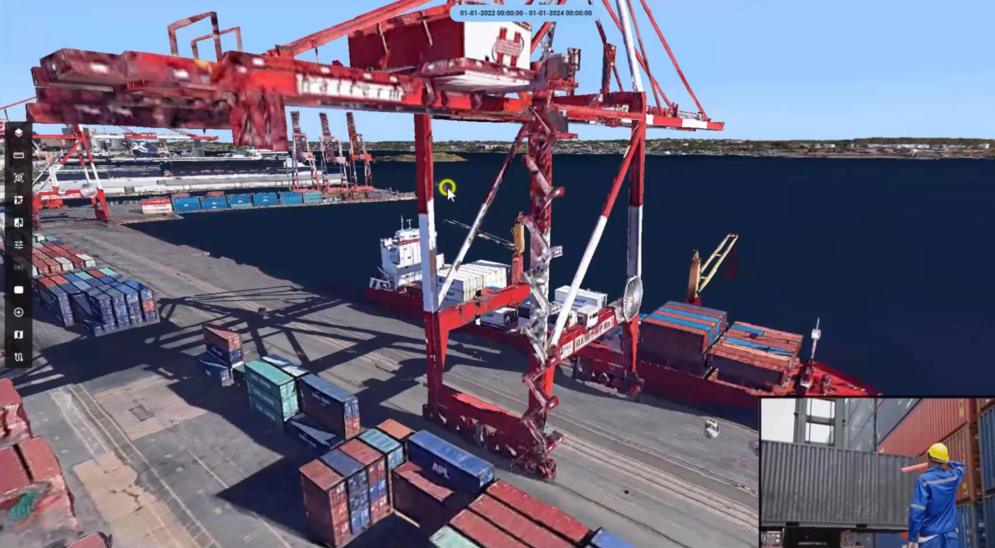
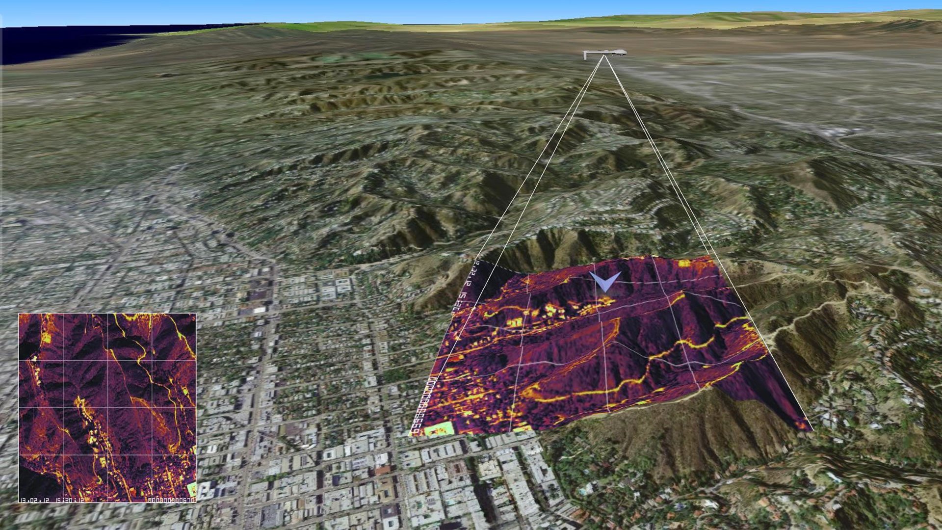
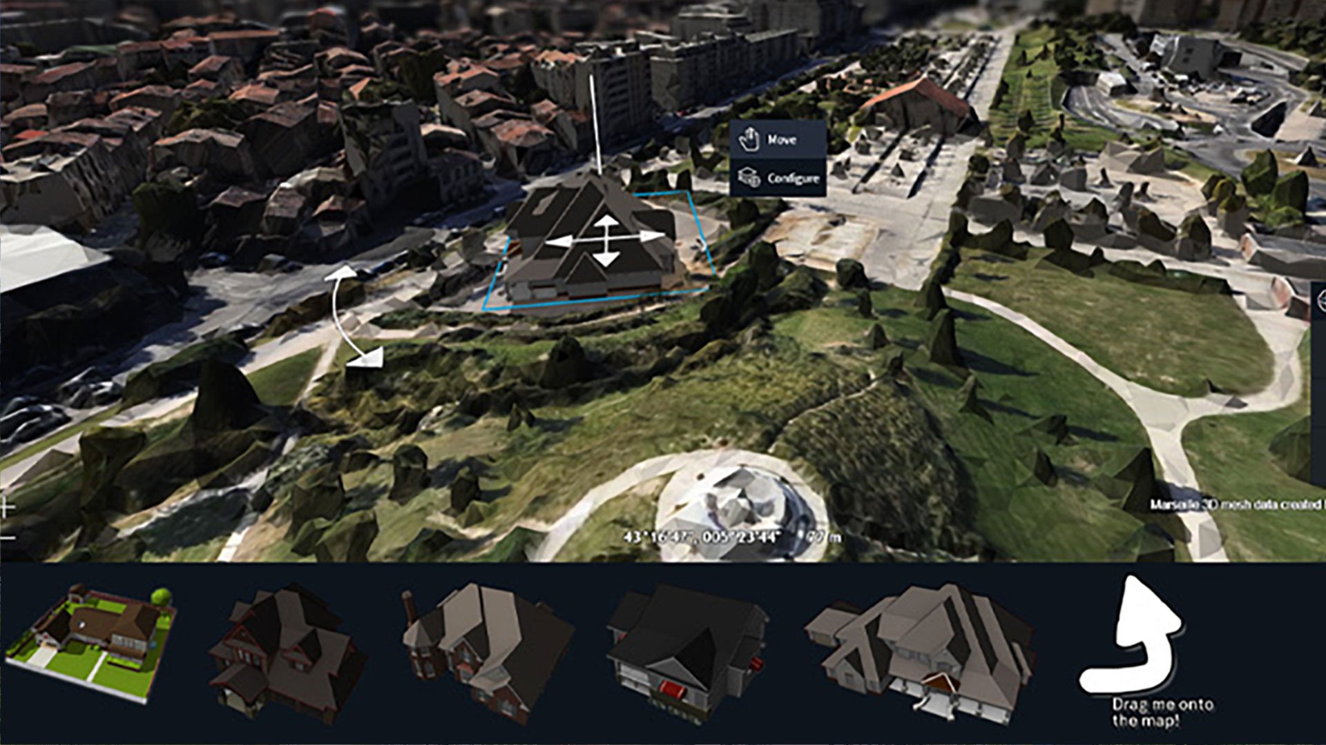
Alto delivers clear, immersive visuals–detailed maps, models and reality data with smooth, responsive rendering at any scale–that help users instantly understand context, change and relationships.
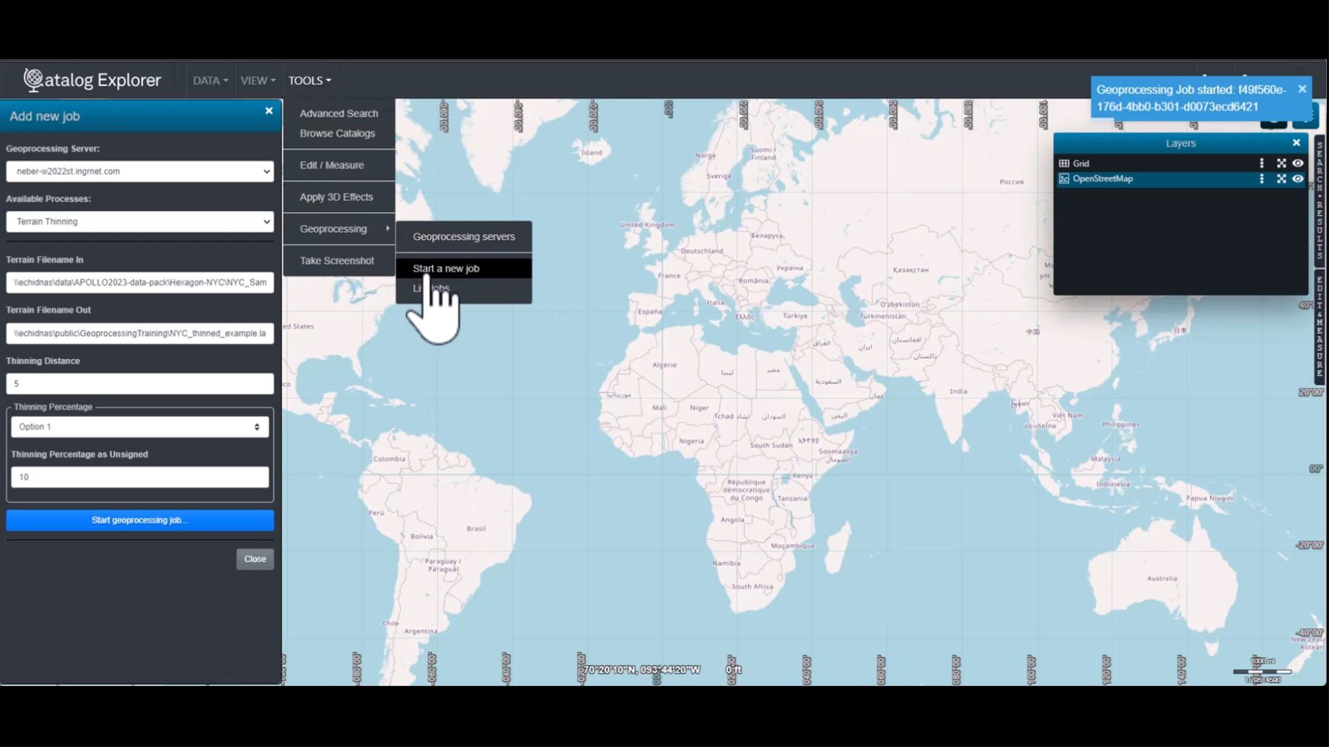
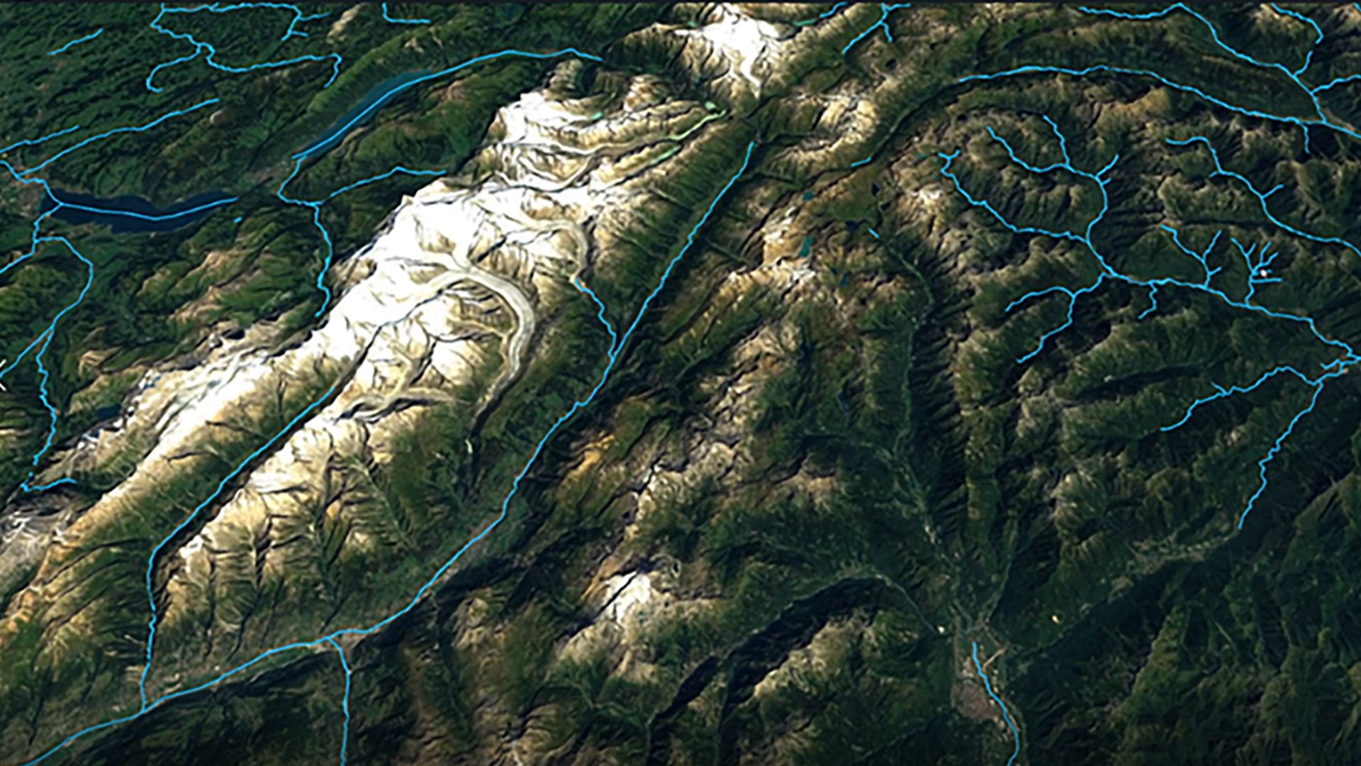
Powerful geospatial analytics and modeling
Alto lets you run spatial queries, calculations and predictive models directly on your data, surfacing patterns, risks and trends quickly and enabling better planning, forecasting and operational insights.
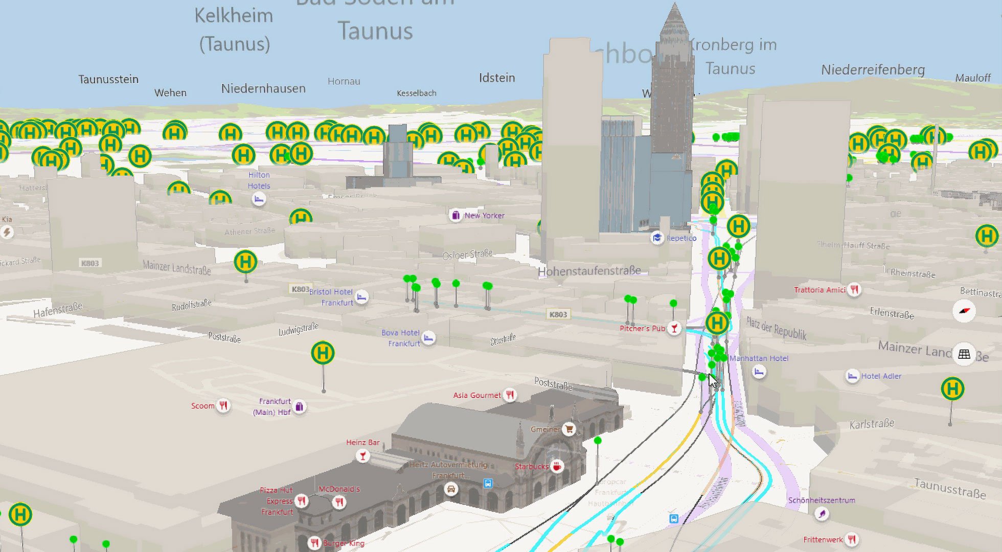
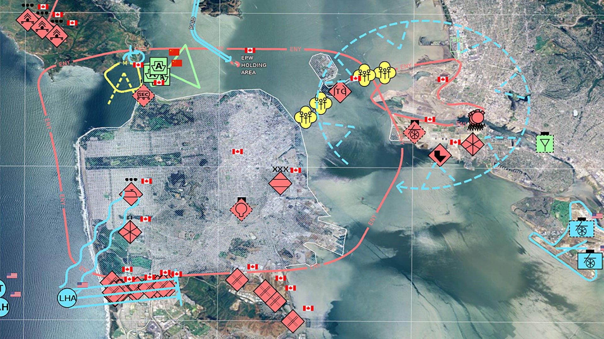
Real‑time monitoring and operational awareness
Alto connects to live data sources, helping teams spot issues early, respond fast and maintain situational awareness. Real‑time feeds are consumed directly in Alto’s visualization and analytics tools for a clear, up‑to‑date operational picture.
Streamlined coordination across teams
Alto brings together data, visuals and context into one common operating picture so teams can share insights instantly, align decisions and maintain consistent situational awareness throughout the organization.

Secure, scalable deployment for the enterprise
Alto supports robust authentication, granular access control and flexible deployment options–on‑premises, in the cloud or hybrid–so organizations can scale confidently and protect sensitive data.
고객 성공 사례
고도화된 지리공간 개발
We're here to help
Get the help you need with direct access to support and resources.