Octave Imagine リモートセンシングソフトウェア
旧ERDAS IMAGINE。地理画像の専門家が地理空間データ処理に取り組むために必要なツールを提供することを目的として設計されています。
データが洞察力となり、洞察力が影響力となる場所。
成果をより迅速に実現
Imagine(旧称ERDAS IMAGINE)を使うことで、リモートセンシングが成果を生み出します。イメージを洞察力に変換します。複雑な地理空間データから、より迅速かつ正確に、確信を持った意思決定に移行できます。現代の専門家の要求を満たすように設計されたImagineは、高度な画像処理、解析、視覚化ツールを1つの強力なプラットフォームに統合しています。
広範な分析と自動化機能
Robust image processing capabilities
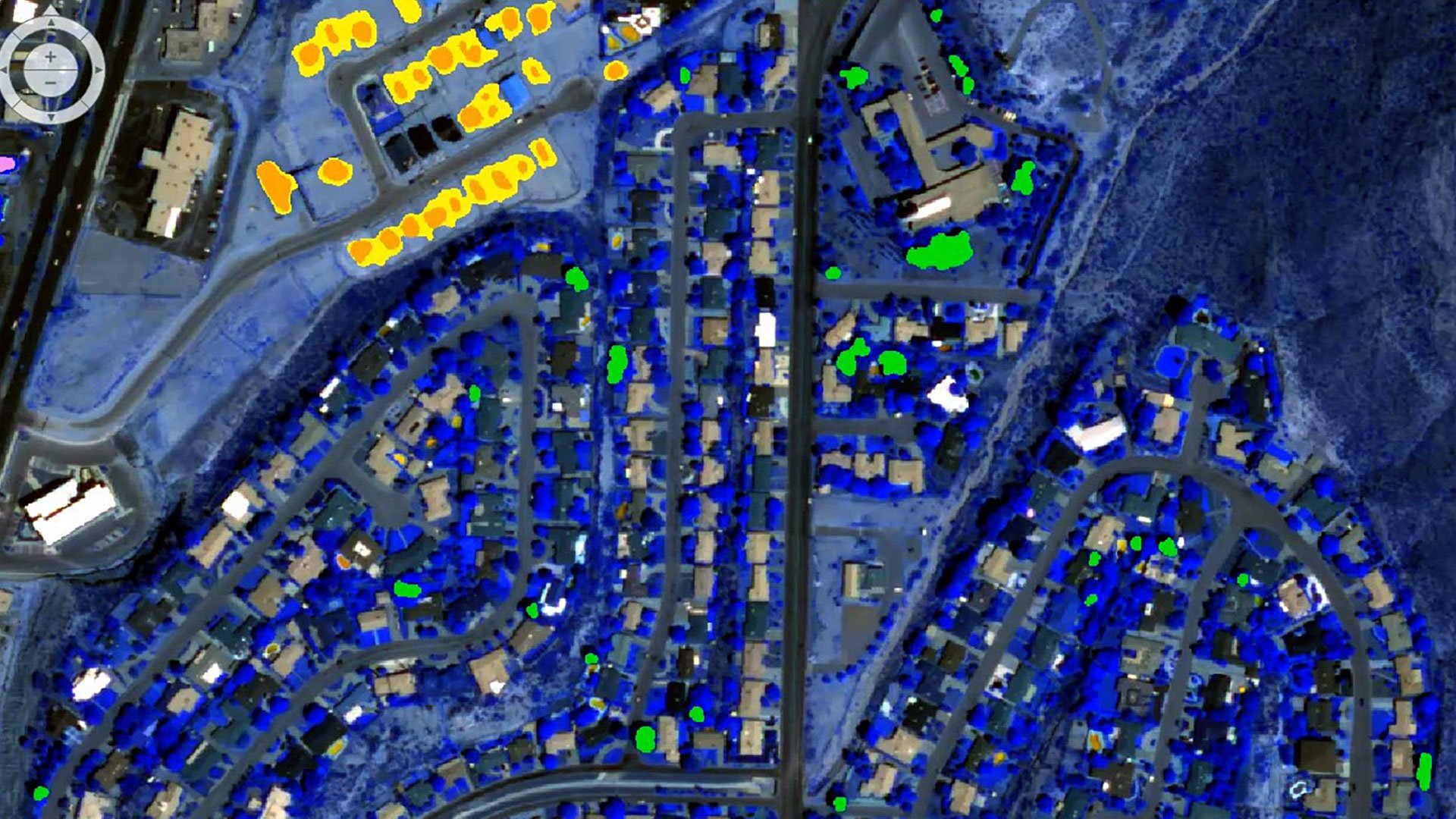
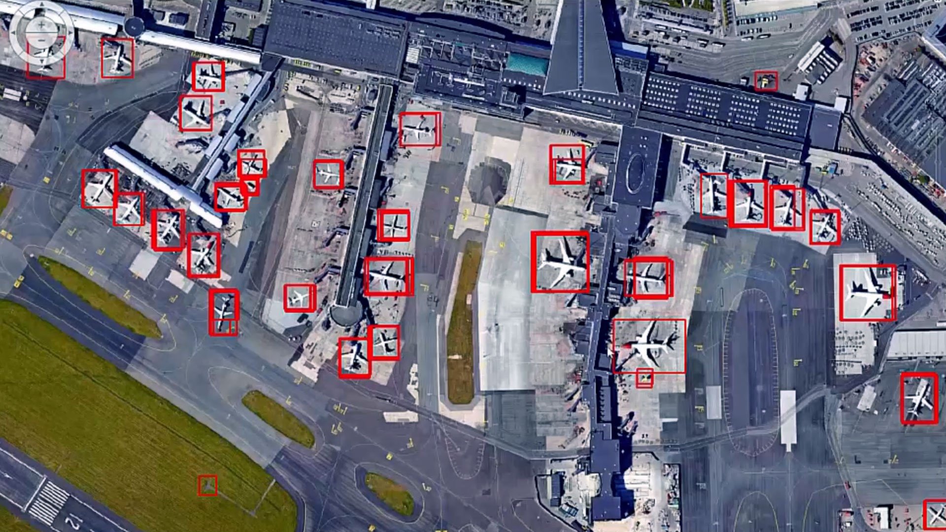
Access a powerful suite of image processing tools, featuring advanced algorithms for image classification, change detection and object-based image analysis.
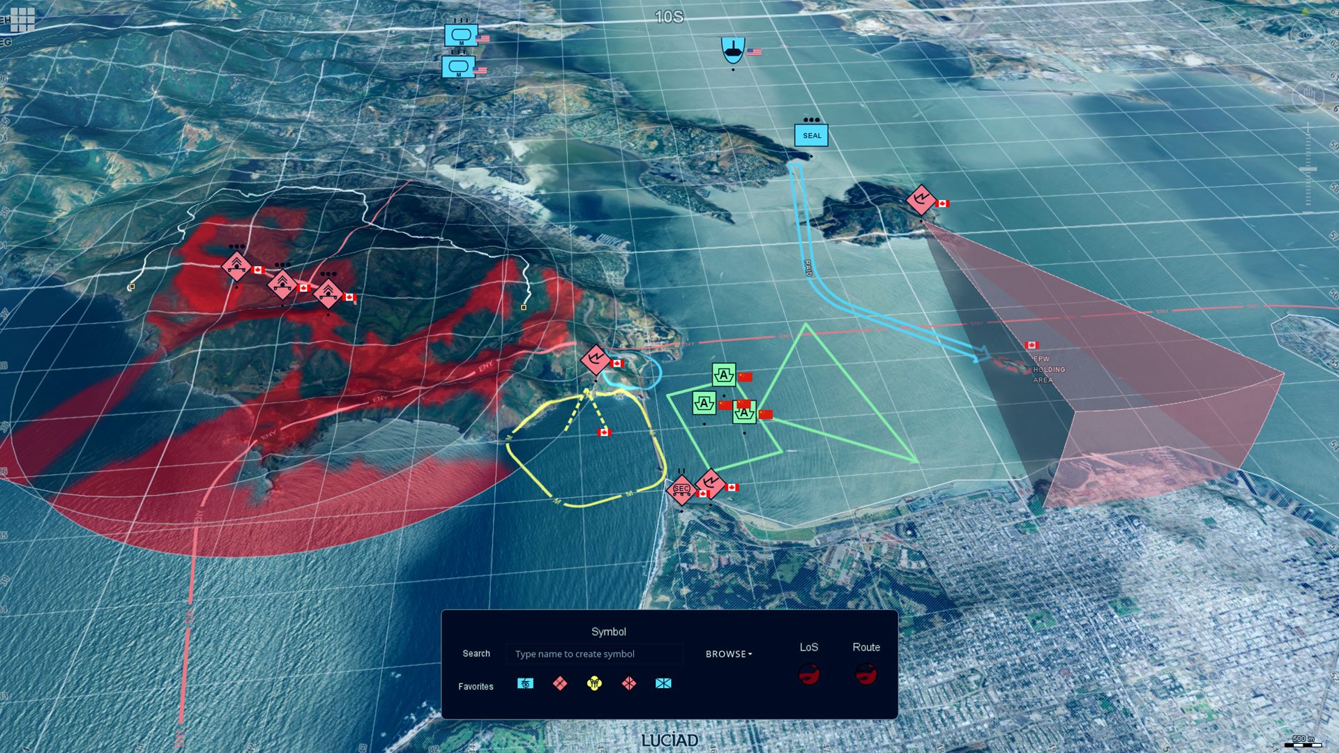
Powerful geospatial analysis
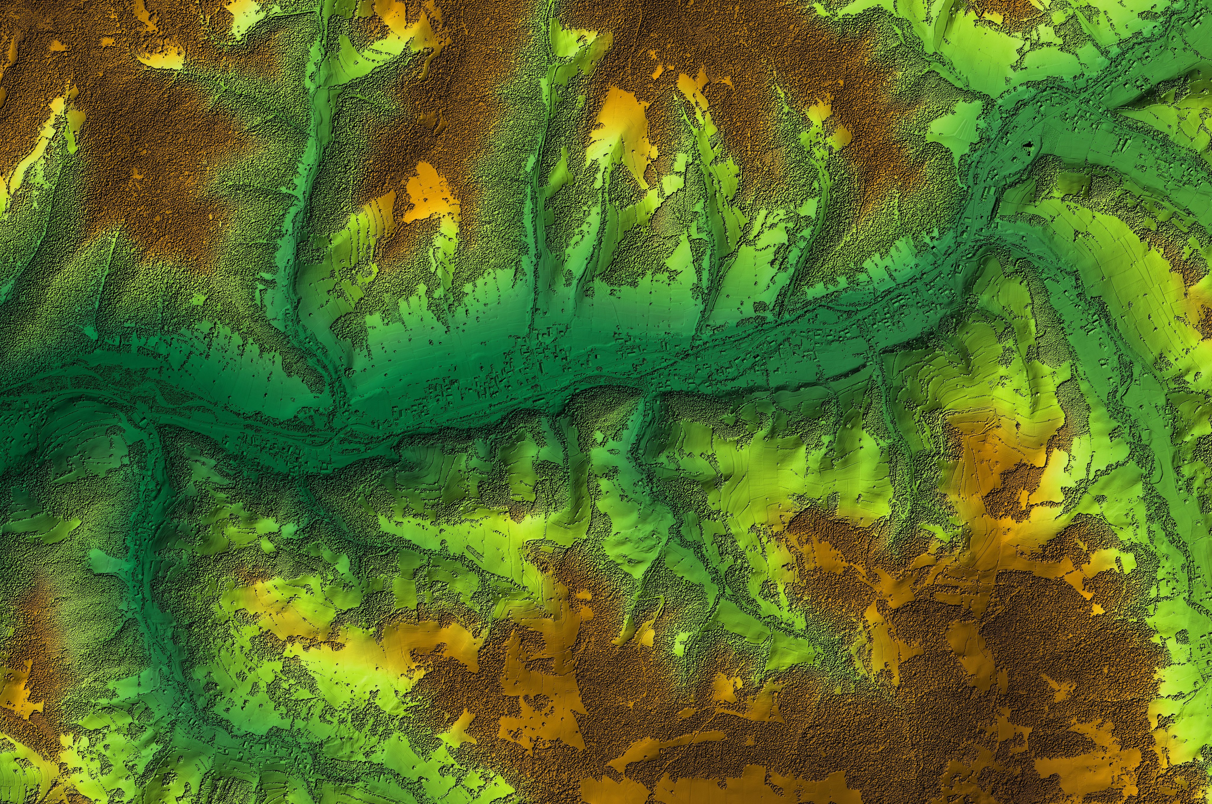
Unlock a versatile set of geospatial analysis tools designed for terrain analysis, surface modeling and immersive 3D visualization.
Efficient workflows
Enhance productivity and save time with the software's intuitive interface and automation capabilities, streamlining your workflows effortlessly.
Extensive support for diverse data formats
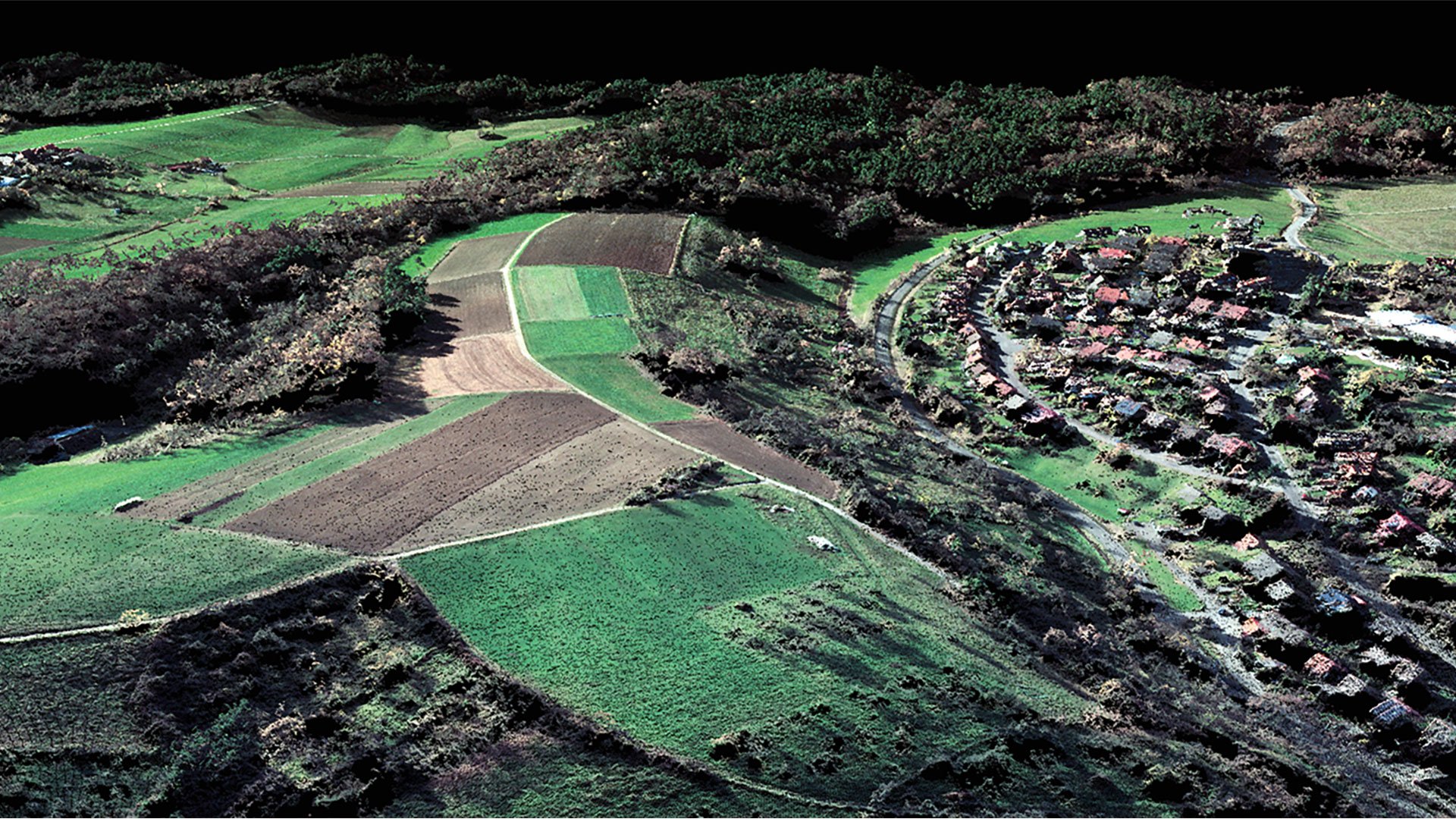
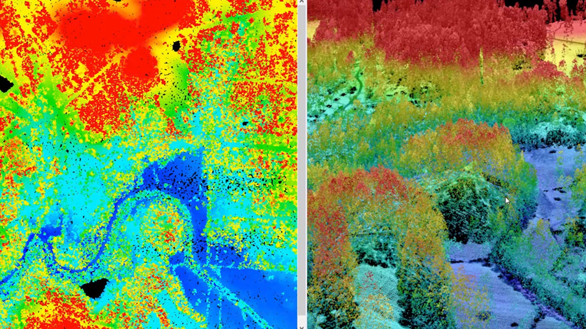
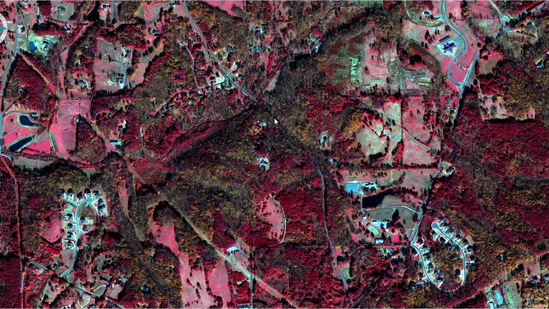
Work with a wide variety of data formats, including satellite imagery, aerial photography, LiDAR and more.

Active community and support
Benefit from a robust community of users and Octave's dedicated support team, offering invaluable resources and assistance.

Interoperability with other Octave products
Imagine integrates seamlessly with other Octave geospatial products, delivering a comprehensive and efficient geospatial workflow.
クライアントの成功事例
企業の進化を実現

いつでもお手伝いします
直接サポートとリソースにアクセスして必要な支援を入手
Extend Imagine with Add-ons
Tailor Imagine to your workflows with proven add-ons. From high-accuracy photogrammetry and dense surface extraction to radar analytics, 3D visualization and lowcode automation, each module plugs in seamlessly so you deliver results faster; without switching tools or rebuilding data flows.
Imagine Photogrammetry は高速かつ正確な三角測量と、画像に対する鮮明なオルソ画像結果を提供します。
Imagine Objective 画像から建物、道路、植生などの特徴を自動的に識別して抽出します。
Imagine SAR Interferometry 複数時期のレーダー画像から、正確な標高および地表の移動データを抽出します。
Imagine SAR Feature Extraction レーダーデータから特徴量や情報を自動的に抽出します。
Imagine DSM Extractor 自動化されたチェックとレポートにより、高密度で正確なDSMとDTMを生成します。
Imagine MrSID Encoder 大容量の画像ファイルを高品質なMrSID形式に圧縮し、高速表示と簡単な保存を可能にします。
Imagine Expansion Pack 3Dビュー、NITFツール、ステレオキャプチャ、レジストレーション、レーダー処理を追加。
Imagine Terrain Editor 3D環境内でデジタル標高モデルを直接編集・改良するためのインタラクティブなツールを提供します。
Spatial Modeler SDK カスタムオペレーター、自動化、AI搭載のモデリングを使用してImagineを拡張します。
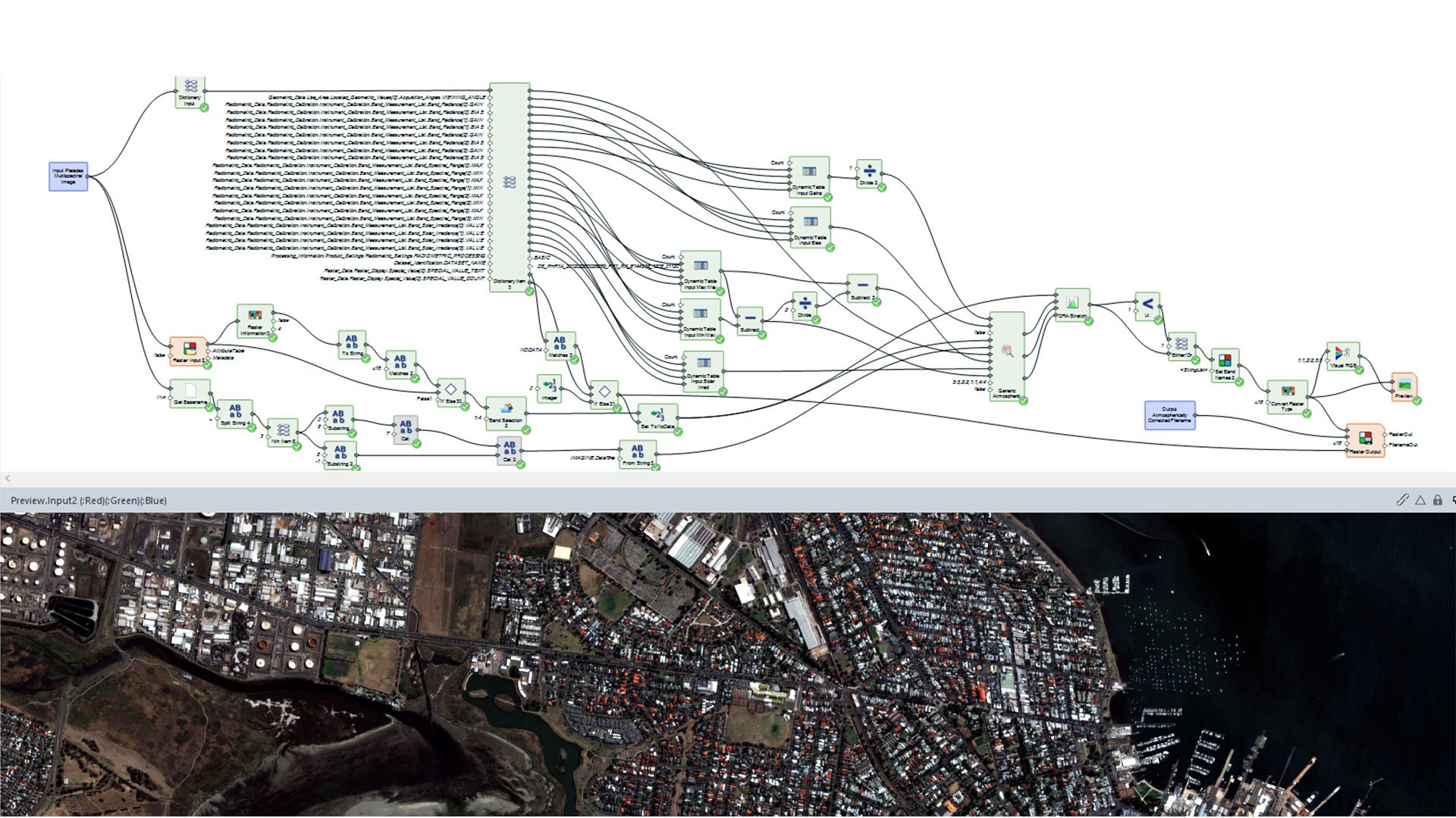
ATCOR workflow for Imagine corrects atmospheric effects and haze to reveal true surface reflectance in satellite imagery.
Imagine Engine 複数のコアやワークステーションに負荷の高いタスクを分散させることで処理能力を拡大します。